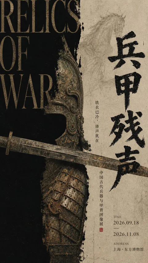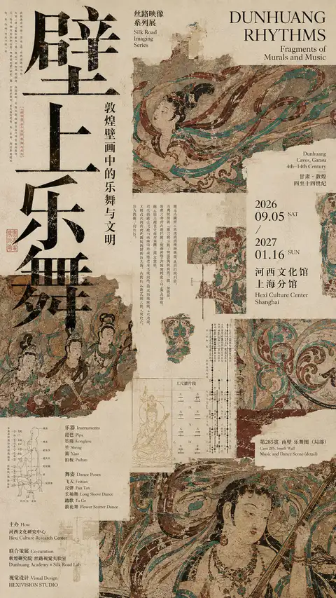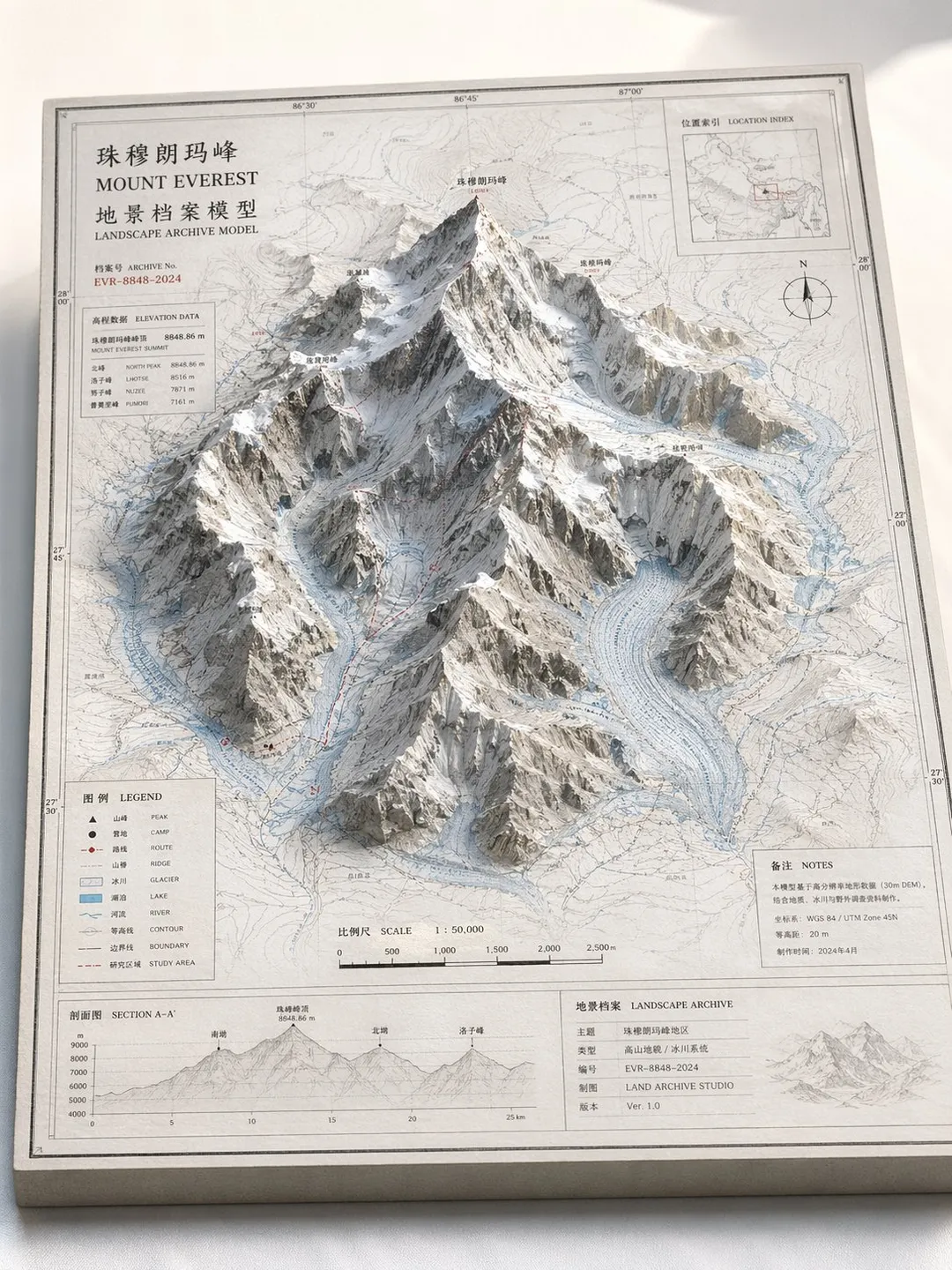
地景档案三维沙盘模型
请根据【主题】创作一张高完成度、高质感、适合系列化发布的「地景档案模型 / Landscape Archive Model」视觉图。

这不是普通地图,也不是普通风景插画或城市效果图,而是一张结合“二维地图图纸 + 三维立体区域模型 + 专业说明系统 + 博物馆展陈感”的高端档案式视觉图。画面需要像一件被真实制作出来的地理研究模型、城市规划沙盘、建筑提案模型或世界观设定展品,具有专业、克制、精密、可触摸的高级质感。

【基础设定】
主题:【主题,例如火山口湖 / 广州 / 重庆山城 / 海岛城市 / 古城遗址 / 末日废墟 / 幻想大陆 / 游戏主城】
主题类型:【自然地貌 / 城市空间 / 混合景观】
核心主体:【核心主体,例如火山口、峡谷、山脉、湖泊、CBD、老城区、地标群、岛屿城市、遗址群、主城区域】
内容重点:【内容重点,例如地形高差 / 城市地标 / 路网结构 / 水系关系 / 自然与城市关系 / 设定集展示】
风格方向:【风格方向,例如地理测绘风、纸雕模型风、建筑提案风、博物馆档案风、城市规划风、游戏设定集风】
主色调:【主色调,例如米白、浅灰、羊皮纸白、沙色、雪白】
辅助色:【辅助色,例如土褐、岩灰、冷灰、淡蓝、苔绿】
点缀色:【点缀色,例如黑色细线、红色路线、蓝色水文线、黄色编号标记】
画幅比例:【画幅比例,例如16:9横版 / 3:4竖版 / 4:5竖版 / 1:1方图】

【画面结构】
画面主体是一块放置在干净桌面或白色布面上的矩形地图模型板。底板具有真实厚度,边缘可见剖面结构,像一块精致的地图切片或模型底座。地图表面覆盖清晰但克制的信息层,包括等高线、道路网络、水文线、分区边界、地理纹理、坐标感、轻微标注和图纸边框。

在地图中央或偏中心区域,从二维地图中立体“生长”出一个三维主体模型,成为整张图的视觉核心。

如果【主题类型】为自然地貌:
主体可由山体、峡谷、火山口、湖泊、盆地、岛屿、冰川、断层、海岸线等构成,强调地形高差、层叠等高线结构、岩壁纹理和自然地貌起伏。

如果【主题类型】为城市空间:
主体可由核心城区、CBD、老城街区、地标建筑群、滨水区、路网节点、桥梁、水系、公园绿地等构成,强调建筑体块、城市识别度、空间层次与规划结构。

如果【主题类型】为混合景观:
需同时整合自然地形与人工建成环境,例如山城、海岛城市、古城遗址、末日废墟、幻想主城、科幻基地等,让自然地貌与城市结构共同构成核心视觉。

【细节要求】
- 模型表面保留地图图纸感与专业信息感
- 地形区域应有等高线、坡面层次、凹陷与起伏关系
- 建筑区域应有体块感、街区关系和清晰层次
- 水域使用低饱和淡蓝色表现
- 绿地、森林、公园、山体可用苔绿色或低饱和绿色表现
- 路网、路径、交通轴线或探索线路可用细线表现,但不要喧宾夺主
- 若有地标建筑或重点结构,应具备明确识别度
- 若有幻想、科幻或游戏设定元素,应保留档案模型和图纸展示感,而不是做成纯场景插画

【说明系统】
地图板边缘需要设计完整而克制的说明模块,包括:
- 外框线和内框线
- 比例尺
- 图例区
- 标题区
- 档案编号
- 索引标记
- 注释标签
- 简洁的符号说明
文字不必全部可读,但整体必须呈现真实、清晰、精密、有秩序的档案式排版结构。

【构图与镜头】
采用斜俯视等轴测或沙盘式构图,镜头从上方约30到45度观察整块模型板,让观众同时看到地图平面、立体主体高度、边缘厚度和说明区。视觉重心集中在中央主体模型,阅读路径为:先看核心主体,再看周边地形/路网/水系/街区信息,最后看图例、比例尺和说明区。

【材质与光影】
整体需要具有真实模型摄影质感:
- 纸张纹理
- 地图印刷质感
- 纸雕或沙盘模型感
- 建筑模型或地形切片质感
- 柔和自然光
- 细腻真实阴影
- 干净背景
- 低饱和、高级、克制
避免卡通化、廉价游戏UI感、过度杂乱、过度炫技,重点突出“地图底板 + 立体主体 + 专业说明系统”的统一视觉。

最终效果应像一张可以用于地理科普、城市研究、建筑提案、文旅视觉专题、世界观设定集或高端系列封面的地景档案模型图。
Please create a highly finished, premium-textured visual of a "Landscape Archive Model" suitable for serialized release based on [Theme].

This is not an ordinary map, landscape illustration, or urban rendering, but a high-end archival visual combining "2D cartographic drafting + 3D volumetric topographic model + professional annotation system + museum display aesthetic." The scene should appear as a physically crafted geographic research model, urban planning diorama, architectural proposal model, or worldbuilding exhibit—exhibiting professional, restrained, precise, and tangible high-grade tactile qualities.

[Basic Setup]
Theme: [Theme, e.g., Crater Lake / Guangzhou / Mountain City Chongqing / Island City / Ancient Ruins / Post-apocalyptic Ruins / Fantasy Continent / Game Capital]
Theme Type: [Natural Landform / Urban Space / Hybrid Landscape]
Core Subject: [Core subject, e.g., crater, canyon, mountain range, lake, CBD, historic district, landmark cluster, island city, ruins, core urban area]
Key Focus: [Key focus, e.g., elevation differences / urban landmarks / street grid structure / hydrological network / nature-city relationship / lore setting display]
Style Direction: [Style, e.g., geographic cartography, paper-sculpture model, architectural proposal, museum archive, urban planning, game artbook]
Primary Tone: [Primary tone, e.g., off-white, light gray, parchment white, sand, snow white]
Secondary Tone: [Secondary tone, e.g., earth brown, rock gray, cool gray, pale blue, moss green]
Accent Color: [Accent color, e.g., fine black lines, red route lines, blue hydrological lines, yellow index markers]
Aspect Ratio: [Aspect ratio, e.g., 16:9 landscape / 3:4 portrait / 4:5 portrait / 1:1 square]

[Composition & Structure]
The main subject is a rectangular map model board placed on a clean tabletop or white cloth surface. The base board has tangible thickness, with visible sectional side profiles, resembling an exquisite map slice or model pedestal. The map surface carries a clear yet restrained information overlay, including contour lines, road networks, hydrological lines, zoning boundaries, geographic textures, coordinate markers, subtle notes, and drafted borders.

In the central or off-center area of the map, a three-dimensional main model "grows" out from the 2D map, serving as the visual focal point.

If [Theme Type] is Natural Landform:
The subject may consist of mountains, canyons, craters, lakes, basins, islands, glaciers, faults, and coastlines, emphasizing topographic elevation, layered contour structures, rock cliff textures, and natural terrain undulations.

If [Theme Type] is Urban Space:
The subject may consist of the core downtown, CBD, historic blocks, landmark buildings, waterfront areas, transit nodes, bridges, water bodies, and parks, emphasizing architectural volumes, urban identity, spatial layers, and planning layout.

If [Theme Type] is Hybrid Landscape:
Integrate both natural topography and the built environment (e.g., mountain cities, island cities, historic ruins, post-apocalyptic ruins, fantasy citadels), allowing nature and architecture to collectively form the central visual.

[Detail Requirements]
- Surface retains cartographic paper texture and professional data feel
- Topographic areas display contours, slope layering, depressions, and elevations
- Built areas display volumetric forms, block patterns, and clear layering
- Water bodies rendered in low-saturation pale blue
- Green spaces, forests, parks, and hills in moss green or muted green
- Street networks and transit axes in thin, clean lines without overwhelming the model
- Key landmarks must have clear, recognizable forms
- For fantasy or sci-fi themes, maintain archival model and blueprint aesthetics rather than pure scenario illustration

[Annotation System]
The borders of the map board must feature an understated, complete technical info module:
- Outer and inner neatlines
- Scale bar
- Legend area
- Title block
- Archive catalog number
- Index markers
- Callout annotations
- Concise symbol keys
Text does not need to be entirely legible, but the overall layout must present an authentic, clean, precise, and orderly archival typography.

[Framing & Camera]
Use an axonometric or diorama-style oblique top-down perspective, angled around 30 to 45 degrees above the model board, allowing the viewer to simultaneously observe the 2D surface, 3D relief elevation, board thickness, and annotation modules. Visual hierarchy centers on the 3D relief, guiding the eye from the main model to surrounding topography/network/water, and finally to legends and scale bars.

[Materials & Lighting]
Must convey real-world model photography quality:
- Paper grain and texture
- Map print finish
- Paper-cut or diorama model feel
- Architectural model or terrain cross-section tactile feel
- Soft natural lighting
- Delicate, authentic soft shadows
- Clean backdrop
- Low saturation, premium, and restrained
Avoid cartoonish styles, cheap game UI looks, excessive clutter, or over-the-top effects; emphasize the harmonious unity of "map substrate + 3D relief model + technical annotation system."

Final output should resemble an archival landscape model visual fit for geography education, urban research, architectural proposals, travel editorials, or luxury artbook covers.
| 模型 | GPT Image 2 |
|---|---|
| 比例 | — |
| 风格 | 3D 与手工 |
| 作者 | Larus Canus (@MrLarus) |
| 原帖 | 查看 X 原文 |
结合二维测绘图纸与三维立体浮雕的地景档案沙盘模型,展现山脉、城市地标与水系路网,具备高精度的图例说明与博物馆展陈质感。
怎么用这条提示词
- 复制上面的原文提示词。
- 粘贴到 GPT Image 2。
- 按 — 生成。
图片与提示词由 @MrLarus 发布于 X,本站仅做收录整理,版权归原作者。